- Home
- →
- Attractions
- →
- Geodesic point «Debesi»
Geodesic point «Debesi»
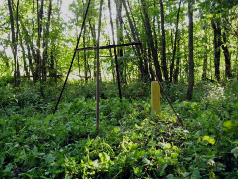
Geodetic Point "Debesi" – one of the unique sites of the famous Struve Geodetic Arc, located in the Grodno region. This network of 265 triangulation points was established in the 19th century to determine the precise parameters of the Earth's shape and size. The Struve Arc crosses 10 European countries and is included in the UNESCO World Heritage List. Belarus has preserved 19 such points—more than any other country. The geodetic point "Debesi" is one of the key elements of this system, attracting interest from both specialists and travelers interested in science and the history of geodesy.
History of Creation
The Struve Arc was established between 1816 and 1855 under the leadership of the renowned Russian astronomer Vasily Yakovlevich Struve, the first director of the Pulkovo Observatory. The main goal of the project was to determine the Earth's precise dimensions, and during the research, it was proven that our planet has the shape of an ellipsoid rather than a perfect sphere. Despite changes in the landscape over two centuries, modern scientists have determined that the difference between historical and the latest meridian measurements is less than 3.5 cm. This confirms the high accuracy of the 19th-century geodesists' calculations.
Excursions with a Tour of the Geodetic Point
For lovers of scientific tourism and history, excursions around Belarus are available, including visits to the Struve Geodetic Arc points, such as "Debesi." This is an excellent opportunity to see one of the most significant world heritage sites and learn more about historical geodetic measurement methods. An excursion from Minsk offers a chance to visit the site of historic measurements, examine preserved markers and pyramids, and understand how this system contributed to the development of modern cartography. Those interested can book an excursion with a tour of the geodetic point to connect with this unique scientific heritage and appreciate the contribution of Belarusian lands to global geodetic research.