- Home
- →
- Attractions
- →
- Geodetic point «Lopaty»
Geodetic point «Lopaty»
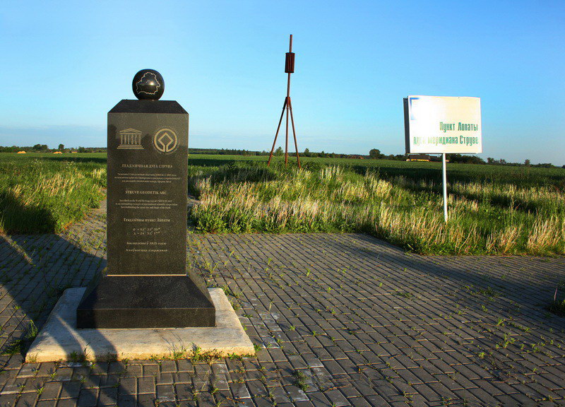
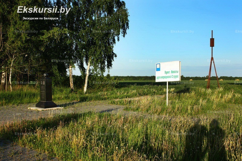
Geodetic Point "Lopaty" – one of the key points of the famous Struve Geodetic Arc, included in the UNESCO World Heritage List. This geodetic network, created in the 19th century, represents a system of 265 triangulation points stretching from north to south across 10 countries: from Norway to Moldova. Belarus has preserved 19 such points, which is a record number among all participating countries.
Located in the Grodno region, the "Lopaty" point is one of six Belarusian points of the Struve Geodetic Arc included in the UNESCO list. It is an important scientific monument that was used in the early 19th century for precise measurements of the Earth's shape and size. Today, "Lopaty" remains a significant site for geodesy and also attracts tourists and researchers interested in the history of science and cartography.
History of Creation
The Struve Geodetic Arc was established between 1816 and 1855 under the leadership of the distinguished Russian astronomer Vasily Yakovlevich Struve, who was the first director of the Pulkovo Observatory. The main goal of the project was to measure a meridian arc, which would help refine the Earth's parameters. Thanks to this research, it was proven that our planet has the shape of an ellipsoid rather than a perfect sphere.
Measurements were conducted using the triangulation method: scientists set up geodetic points on elevated areas and measured the angles between them. Despite the lack of modern technologies, the accuracy of the calculations was astonishing—the difference between contemporary data and 19th-century measurements is less than 3.5 cm. This confirms the exceptional skill level of geodesists of that era.
At the geodetic point "Lopaty," as well as at other points of the Struve Geodetic Arc, a metal four-sided pyramid is installed, marking the site of historical measurements. This site remains an important part of global scientific heritage.
Excursions with a Visit to the Geodetic Point
The geodetic point "Lopaty" is part of tourist routes across Belarus dedicated to UNESCO World Heritage sites. It is an ideal destination for those interested in the history of science, geodesy, and cartography.
You can book an excursion with a visit to the geodetic point "Lopaty" and learn how, more than 200 years ago, scientists managed to measure the Earth with astonishing accuracy without modern instruments. An excursion from Minsk will allow you not only to see the geodetic point itself but also to enjoy the picturesque landscapes of the Grodno region.
During the excursion, the guide will explain the measurement methods used in the 19th century, the significance of the Struve Geodetic Arc for global science, and the history of Belarusian geodetic points. As part of a tour across Belarus, you can also visit other points of the Struve Geodetic Arc, where commemorative obelisks are installed.